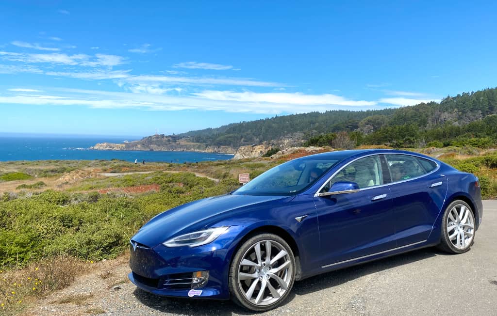
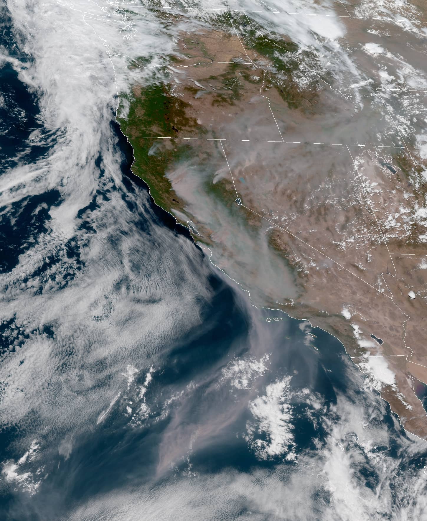
Tesla Model S - Point Reyes* LNU Lightning Complex
|
| |
Wednesday, August 19, 2020
|
|
Days Charging at
| |
Destination
|
|
Supercharger
| |
0
|
|
1
|
|
| Agate Cove Inn
|
|
We placed our order for breakfast with Agate Cove Inn the evening before so
it would be ready for us promptly this morning.
It was amazingly good, with eggs, bacon, and all the fixings.
In many ways the service at these smaller hotels were
better than those offerred at large ones because they're able to adapt.
By charging overnight here of course the car was full and ready for us in the morning.
I also bought a picnic lunch from Agate Cove Inn,
which we later stored in our portable cooler in the back trunk,
because we were not sure exactly where we were going to eat lunch today.
|

|
Although we wanted to take a comfortable morning,
I made it clear that to the family we have a lot of distance to travel today, so
we should not depart too late.
My major destinations for today included both the Point Reyes National Seashore
and a view of the Golden Gate bridge from the north, plus whatever sightseeing we can
accomplish by driving the
Shoreline Highway southwards.
|
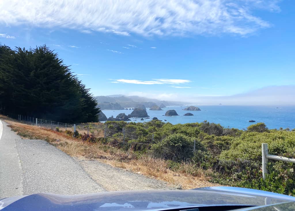
| Shoreline Highway
|
|
My wife's family would take her to this area when she was growing up,
staying at Sea Ranch (see below) then driving north and south along this coast.
Her problem was that back then she would get carsick on the drive between Mendocino and Sea Ranch.
It turns out that was no different for her today.
I did my best to take the curves as gently as I could.
My son was fine, even looking down at his iPad from time to time,
and my daughter handled it fine.
I of course was having great fun driving this beautiful coastline,
seeing the blue ocean and the white wispy clouds, and smelling the salt air
after being in the mountains for a couple weeks of this trip,
but to limit the centrifugal forces I could not go fast.
|
|
|
| Gualala
|
|
We eventually made our way to Gualala,
a common stop for tourists here and for my wife's family when
she was a child.
For old times sake, her family had me along in 2005 to a week-long stay in Sea Ranch,
and one of our stops was some shopping in the town of Gualala.
The problem today was the construction, here in Gualala,
but also in several stops north and south of here.
It made our travel take longer, waiting for flag men to direct us.
That was making me a little concerned about how long the drive to our hotel stay would take.
I knew that at several points along the Shoreline Highway I could abort and travel to
the faster highway 101 to save time, but that would mean missing the coastal views.
Still it was a beautiful day.
|

|
|
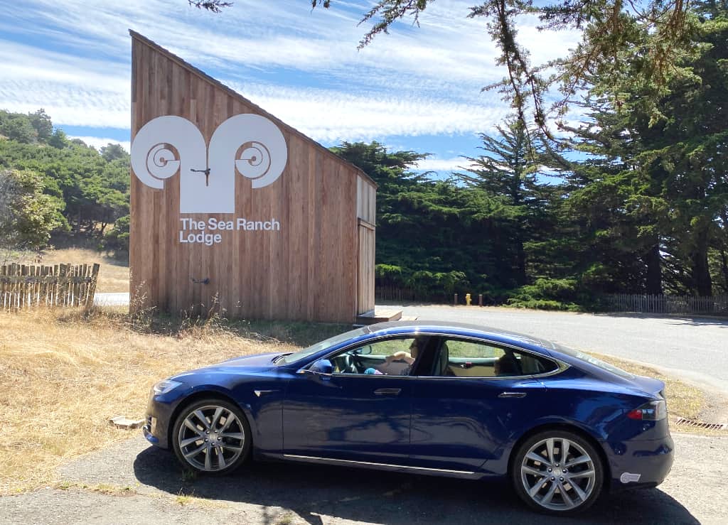
| Sea Ranch
|
|
And it was not long until we located Sea Ranch.
My wife and I recognized the grey wood paneled small houses and small buildings jutting out of
the coastal scrub and mixed with unique evergreens that gave Sea Ranch its distinct look.
The last time I was here was before either of my children were born,
so we had to explain how my wife's extended family would visit here often,
but we do not any more because almost all of them have migrated to Southern California.
Sea Ranch is even on the Tesla Destination Network, so I knew that if needed
I might be able to use the Tesla-native charging stall here.
I had considered staying here, but I think they're generally set up for
staying much longer than a single night like what I needed on this trip.
|
|
|
It was neat to see this place.
We were hoping to use the restroom but could not.
Unfortunately with the pandemic, Sea Ranch was basically shut down.
The restaurant and the lodge here were closed,
with portions even under construction.
Instead we had to continue south.
|

|
|
| Stewarts Point
|
|
Again it was such a pristine day driving south,
but now we were on the hunt for a restroom.
Fortunately we found one at a store at Stewarts Point.
After using the facilities,
we checked inside, and they had both gifts and some limited food to eat, but
nothing especially appealing to us.
|

|
|
| Horseshoe Cove
|
|
Again the seemingly endless rugged California coastline.
I wasn't sure where to stop or where to take pictures.
The experience to drive it in this car was the fun unto itself for me.
The weather was just perfect.
|
|
|
| Windermere Point
|
|
At this point I was on a greater lookout for interesting places to take pictures.
There were not very many places to eat so far south of Gualala, and we
were nearing lunch time, but our family could hold out a while longer.
We passed Timber Cove, which had another hotel I considered staying at because it
too was a member of the Tesla Destination Network.
Which one I picked just depended on how far I thought we could drive between destinations.
Just south of that was a pretty campground and hiking area near Windermere Point.
|
|
|
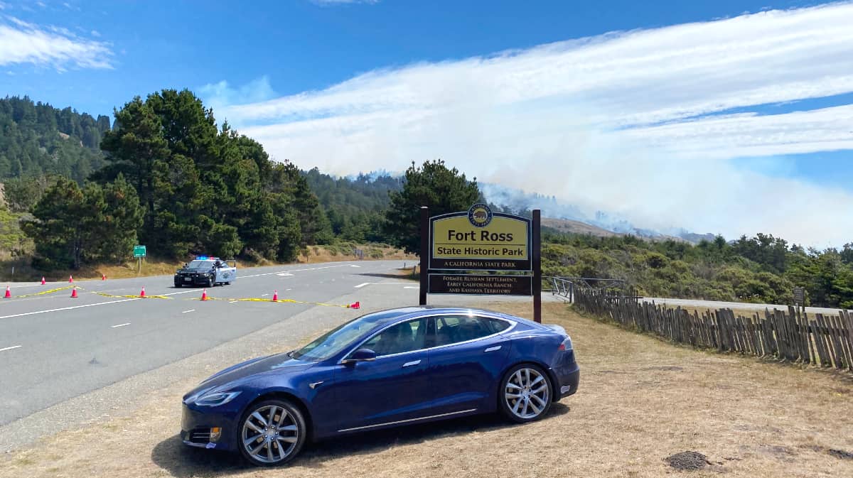
| Fort Ross
|
| Time | Event | Range Remaining |
|---|
| 9:53 am | Departed Agate Cove Inn | 315 |
| 12:23 pm | Arrive Fort Ross | 227 |
Range/Distance ratio: 1.14
Conditions: Shoreline Highway, slow, winding road, then Blocked!
|
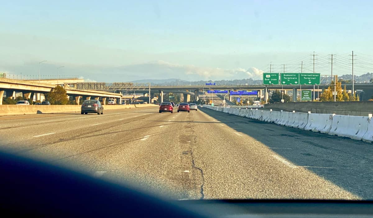
To my great surprise, we discovered a California Highway Patrol car and officer blocking
Highway 1 southbound (see top picture) using cones and yellow police tape.
I could not believe what I was seeing at first.
There was a woman in another vehicle trying to argue with the officer about the blockage,
trying to get past
the officer, to no avail.
I pulled over at first to assess what was going on.
Our phones and the car did not have reception here so we could not independently determine
the extent of the situation we were facing.
|

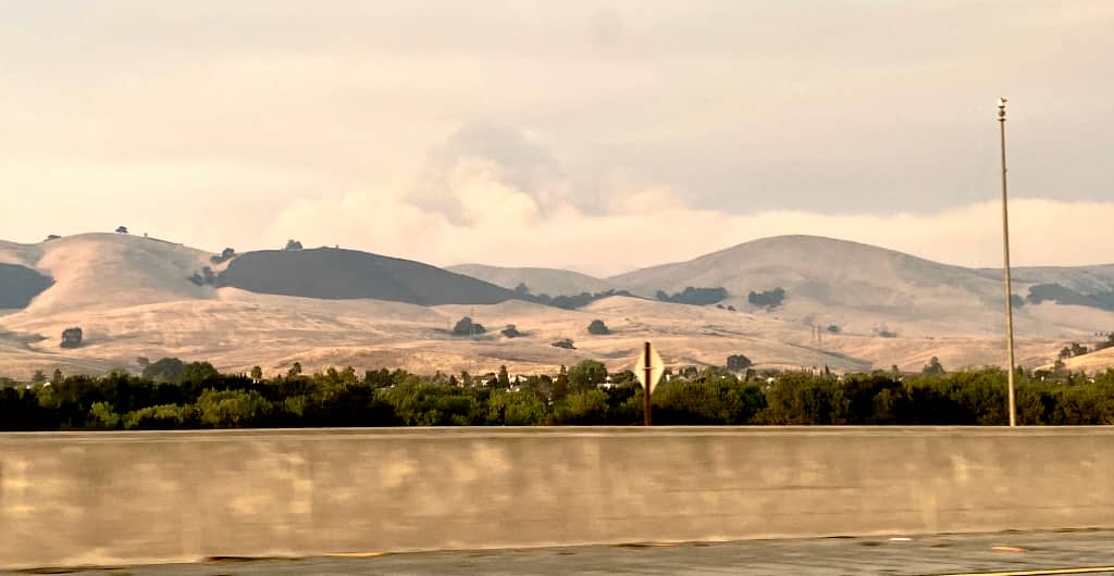
But it was pretty darn obvious to see the smoke from flames just
on the other side of the ridge line to the south.
|
After the other woman turned around and drove north,
I walked up to the yellow line and asked the officer some questions.
He told me that the fire and closure went all the way to Jenner, which is
just north of highway 116, our next opportunity to abort and go back to highway 101.
Therefore that escape route was not accessible.
I mentioned that we were there just to enjoy the coastline,
while acknowledging
the fire is the fire.
|
Point Reyes
|
* I was really hoping to visit Point Reyes today because I had never been there before,
and I read it was pretty and the Point Reyes lighthouse would be an interesting place to see.
I was even thinking about visiting Bodega Bay if we had time.
I had already cut for time a few other lighthouses to visit in Oregon and Washington,
but I accepted those cuts because this lighthouse was at a reasonably convenient time and place on the trip.
Unlike this trip's other unplanned detours or cancellations,
this one was not due to the pandemic.
Instead it was dictated by a naturally-occurring fire big enough to close a substantial section of a major highway,
much like the
Blue Cut fire did to us on our road trip four years ago.
What makes this trickier is that we're a day further away from home than then.

|
Alluding to what Jim Lovell said as portrayed in the 1995 movie Apollo 13,
I told my wife:
"We just lost Point Reyes."
I did not know how serious this was at the time, only seeing the edge of a fire on the coast.
Only late in the day,
when I had Internet access, I could pull up information about the closure and the extent of the
area affected by, not one fire, but the fires.
What I did know was we had to turn around and drive north, which I did.
As I began the detour I'm thinking about our strategy.
My original plan was to use the Corte Madera Supercharger, and
in the morning I had primed the navigation in the car
(so it have the route cached in memory in case we lost reception)
with that destination already as a reference point for my use of charge
relative to Point Reyes.
I restarted navigation to Corte Madera from here,
to continue to have the computer provide that reference data.
|
|
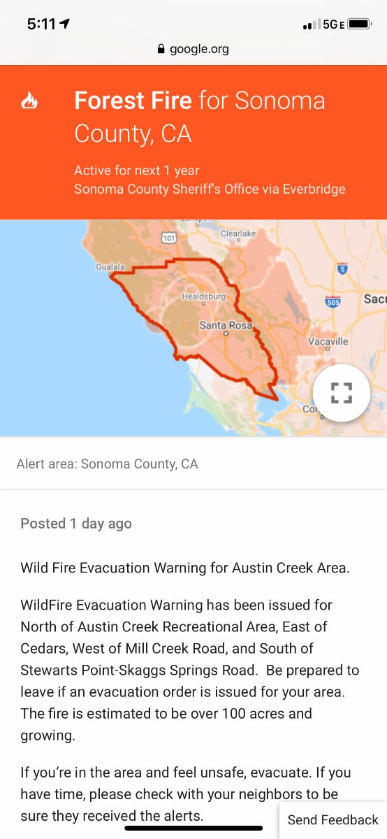
It turns out, as I learned at the end of the day, there was also an ongoing fire in Point Reyes itself,
so even if we did reach Point Reyes, we couldn't enter.
|
What was I most worried about? Time.
Do we need a "Time Anxiety" icon here?
I didn't want to check into our next hotel too late, as in, uncomfortably late.
I wanted my family to all get a good night's sleep
after a day disrupted by fire. My family's well-being was high priority.
|
|
 |
"Whaddya gonna do when you run out of battery?
What are you going to do about charge?
I'm getting worried!
I've never done what you're doing;
I'm getting palpitations again!" |
 |
|
|
 |
 |
- driver who does not own an all-electric vehicle
who imagines they know more about BEVs than experienced BEV drivers know
|
For drivers who don't own a BEV:
First: That's a Loaded Question fallacy
because it has a false presumption.
Second: What was I NOT worried about? Charge, because:
- the Tesla's big Navigation map
showed
five Supercharger sites on the
nearest parts of highway 101,
therefore as long as I could get to highway 101 somehow,
which was now mandated anyways
by the fire I could see (and, in a way, by the California Highway Patrol),
accessing a Supercharger would both be a cinch
and an automatic gateway to address other
closer-term priorities like meals and the restroom.
-
Besides I already knew
Tesla-native plugs of the Tesla Destination Network, another charging-network layer,
were installed along Highway 1 at Timber Cove, Sea Ranch, and
others all the way back to Mendocino.
All those charging locations were in the Tesla Navigation in the car.
With seven years of all-electric road trips under my belt,
I find it astonishing and dismaying how
drivers who don't own a BEV act ignorant of these long-standing facts about Tesla cars.
What will it take for
their
ignorance and
bed-wetting
to end?
|
Since reception was poor on all our devices, we had a hard time
finding which route we could take to get to highway 101.
We stopped by Stewart Point because that had reception.
But then a kind fellow at the parking lot at Stewart Point came up to us because
he saw my Harvey Mudd College license plate frame on the back of my car.
He was an Harvey Mudder too, maybe five years ahead of me as I recall,
and he lived locally here. We talked about the fire and how that is diverting us to
find a way to highway 101.
He knew that the road nearby over the mountains was a gravel road,
which was no good for us because
that would require us to go very very slowly, taking more time.
So when we looked for roads further north he believed that Mountain View Road near Stornetta
would be a paved mountain road that could get us to highway 101.
We thanked the fellow Mudder and continued north.
| Salal Picnic Area
|
|
To get to Stornetta it was going to be a long drive doubling back on road we already traveled.
We made it almost to Gualala, but we were all getting hungry,
so we stopped at the Salal Picnic area near Gualala Point to
pull out that picnic lunch from Agate Cove Inn
and have a brief stop to eat.
|
Like our other favorite places for lunch,
this was a pretty place, and around here the weather was great.
We all ate up as much as we can while here because it could be a long drive to our next meal.
The restrooms, as pit holes go, was acceptable and necessary.
|
|
We read off the names of the small towns and sights as we continued north
to make sure
we do not miss the turn after Stornetta.
Anchor Bay, Fish Rock, Point Arena, and Flumeville all went by.
|

|
Finally we passed Stornetta and look for Mountain View Road, and we confirmed it was paved.
We made our way east and once up into the mountains the
paved road ends up very winding and surprisingly bumpy.
It seemed like over the years the hillside underneath gave way
unevenly, leaving the paved surface unpredictably bumpy.
That made the drive less comfortable.
For thousands of miles so far we were on excellent roads with new tires in an all-electric car with
far fewer vibrations than in an internal-combustion car,
so for the first time in years I had to tense up my body against the bumps in the road
so that I can keep my foot steady on the pedals so the ride isn't lurchy for my family.
The lines were not well-defined enough on this rarely-maintained, sometimes-single-width road to use Autopilot.
It took a lot of my human energy to keep the drive as smooth as I can for my family.
It took a while, but eventually we made it over this small mountain range to reach Boonville and
the intersection with highway 128, a much nicer and better-maintained two-lane highway.
It took us to Cloverdale where we could get on highway 101.
|
| Walbridge Fire
|
|
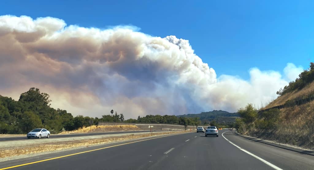
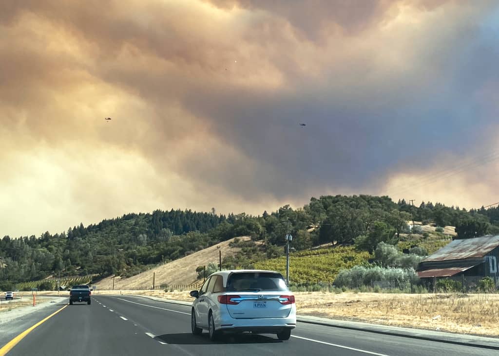
Once we reached the 101 we could finally begin to see how bad this all really was.
We could see the smoke and orange haze from what we would later learn was called the Walbridge fire.
It was bad, really bad.
It was so bad we could see the enormous clouds of soot, smoke, and ash flying up into the sky.
It wasn't long before we could see water-laden helicopters taking their load to the source of the smoke.
Now that we were safely on the big highway,
we had many Supercharging choices on our path and within our reach,
and we had full reception in the car and on our phones.
I could turn on Autopilot, so my wife and I could use the navigation to zoom in
on each Supercharger location and look for places to eat nearby.
Our choice was Petaluma,
the home of the famous podcaster Leo Laporte
we listen to and whom I've met in person years ago in Ontario.
This Supercharger stop was in a big mall with lots of choices to eat dinner.
I joked we might meet Leo.
We skipped past the Santa Rosa and Rohnert Park Superchargers.
|
We did not bother with the Novato, Corte Madera, and other Superchargers we could also reach
because, now well over two hours past the time we left Gualala Point,
we were hungry and needed the restroom.
The Tesla navigation saying that the Petaluma Supercharger had 17 stalls available was icing on the cake.
|
|
|
|
|
| Petaluma Supercharger
|
| Time | Event | Range Remaining |
|---|
| 1:49 pm | Depart Gualala Point | 214 |
| 4:31 pm | Arrived Petaluma Supercharger | 52 |
Range/Distance ratio: 1.17
Conditions: Uphill, winding & bumpy mountain roads, smoke & ash
We found the Supercharger, plugged in,
after having trouble choosing from the forest of stalls,
and decided on dinner at the mall.
Turns out there was a Chipotle and Five Guys right next to each other, so my wife and kids had Chipotle,
and I had Five Guys.
And we had a chance to rest and recoup.
|
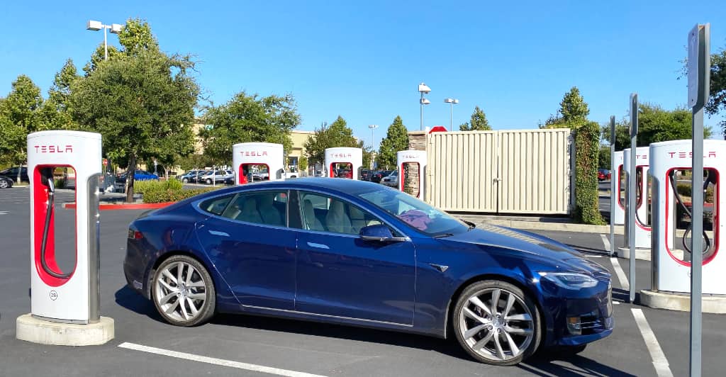
Cost to Charge: $0
|
The problem was only outdoor seating was allowed,
and the smoke and ash from the fire was palpable here, falling on everything.
The months-long pandemic led to rules that forced us to eat outside, and
the brand-new fire made it uncomfortable to be outside.
This was not ideal but there was nothing we could do about it.
In terms of progress on the route,
we were almost three hours behind my original itinerary.
I could squarely blame it on the fire, because
without that we would not have had to backtrack
and reroute adding well over 100 extra miles to our route, much of it on slow roads.
But the Tesla technology performed beautifully through all these other externally-caused difficulties.
And it was not even done performing yet.
Every minute we spent here we used to address and anticipate our human, physiological needs.
That includes how, after dinner, we
stopped by the nearby Sprouts to pick up supplies,
especially water, snacks, and other refreshments, just in case.
|
| Golden Gate Bridge
|
Once we made sure our entire family's physiological needs were met,
we unplugged from the Petaluma Supercharger and continued south.
My itinerary had one more sightseeing stop we could still make,
and I knew I did not want to miss it because the view on this particular day would be so unique.
It was a little tricky to navigate the tunnels to get to the right viewpoint in Marin Headlands,
but I did it.
Lots of other people in cars were just hanging out there.
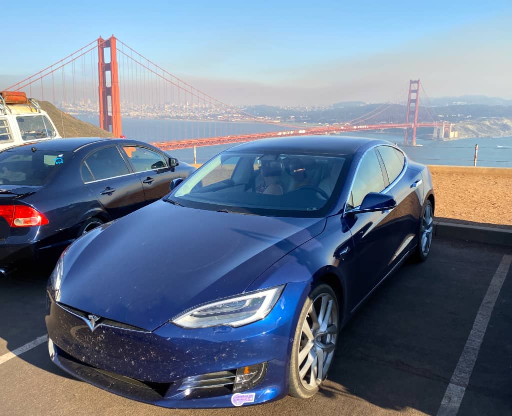
When I pulled up to see the view,
I was amazed.
I immediately had to hop out and look.
However I was greeted by choking soot and smoke affecting my nose and eyes,
but I was determined to complete my photo shoot here.
My family just stayed inside the car with Dog Mode on.
I had never seen this bridge from this view before,
and now my first impression of the north view of the Golden Gate Bridge
will always be one of orange haze and choking, eye-watering smoke.
I felt overwhelmed by the happenstance and unique situation we were in,
a moment in space and time that will almost never be seen again.
Here this famous view of the ocean entrance to San Francisco that you see in postcards
shows a city on this day drowning in smoke so bad it seems as if the city is on fire.
It should be highly unlikely anyone would see San Francisco quite like this again.
|
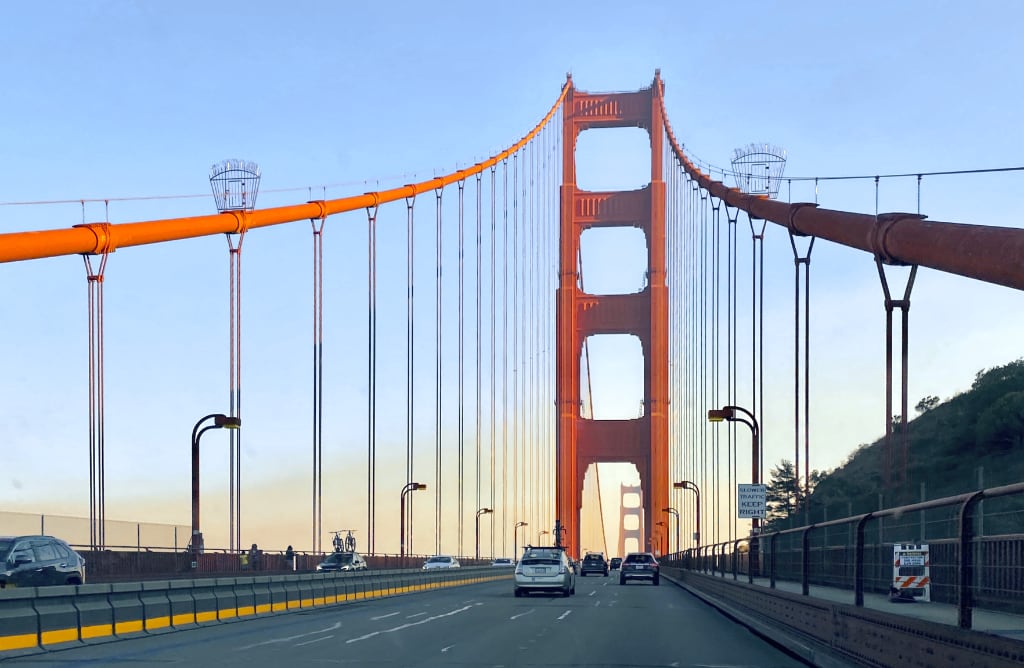
The discomfort in the air and our timing
gave clear reasons to keep going, so
we left Marin Headlands and
joined highway 101 to cross the
Golden Gate Bridge south because that was the quickest path to our destination
and already on my planned itinerary.
I don't remember ever driving the Golden Gate Bridge southbound myself before.
More importantly, this was the only time my children have crossed the Golden Gate Bridge.
What a strange day it turned out to be.
We could see the orange smoky haze from the bridge.
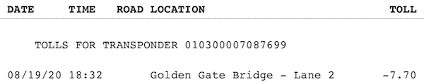
I already had a FasTrak sticker on my windshield so it was no problem crossing legally.
As a 4-person carpool with diamond-lane zero-emission stickers,
I thought I was a shoo-in for the $5.70 toll so I took the
carpool lane toll lane.
When I complained of an overcharge the following month (it had the correct transponder number)
they told me I had the wrong
type of transponder for that discount.
|
|
|
| San Francisco Peninsula
|
|
Because we were behind schedule due to the fires to the north,
I just took the fastest route to our hotel.
In my original itinerary I was thinking of taking Highway 1 to see the coastline
on the way to Santa Cruz.
It turns out that route was blocked by a different fire,
later known as the CZU Lighting Complex Fire,
so I couldn't go that scenic highway this day if I wanted to.
The Tesla Navigation took us through downtown San Francisco
and by San Francisco State University, where I had never been before,
and San Francisco International Airport.
Everything here was cast in an orange haze,
illuminated by an orange sun.
The air outside was so bad we had to turn on
Bioweapon Defense Mode.
|
|
Further south we could easily see yet another fire inland of us, the SCU Complex Fire.
We traveled all this way through other states to see dozens of other places and drives
thousands of miles of roads we've never driven before,
and our welcome back to our home state of California was a state that was literally on fire.
The transformation of this day was astonishingly rapid.
|
| Carmel Mission Inn
|
| Time | Event | Range Remaining |
|---|
| 5:40 pm | Departed Petaluma | 298 |
| 6:27 pm | Departed Golden Gate Viewpoint | 248 |
| 8:47 pm | Arrived Carmel Mission Inn | 84 |
Range/Distance ratio: 1.27
Conditions: Toll bridge, city, traffic, smoke,
Bioweapon defense mode on
By skipping some of the sights after Golden Gate bridge I made up some time and
arrived
only about two hours behind schedule, but we made it to Carmel Mission Inn,
a member of the Tesla Destination Network, at a
not completely unreasonable hour.
There was a pool here, but we did not bother because of the ash falling from the sky.
|
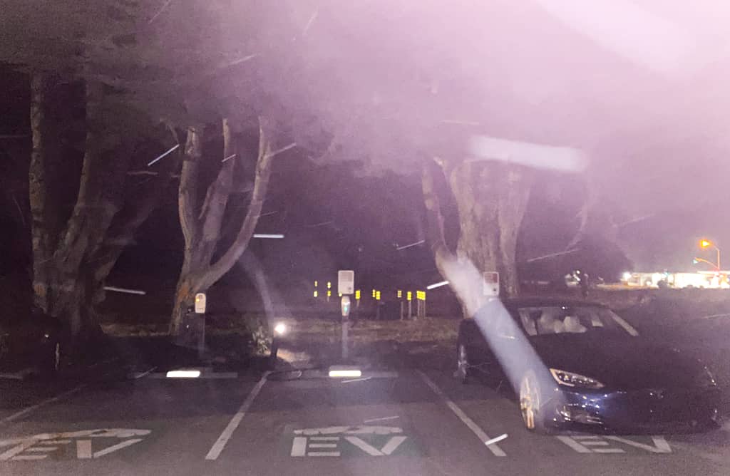
After we checked in and unloaded the car,
I found the Tesla-native charging plugs.
Those white streaks are ash, not snow, falling from the sky, probably originating from the Carmel Valley Fire, yet another fire.
Cost to Charge: $0
|
After we settled into our room and shower, we caught up on the news and
what all these fires are about.
We were amazed and astounded.
It turned out that
sign we saw on Cascades Lakes Scenic Byway three days ago
told us this could happen because it happened 22 years earlier in Oregon.
Let's take a closer look at that sign near Elk Lake:
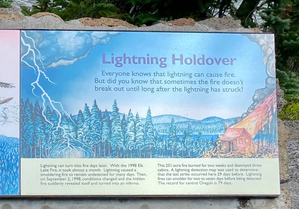
The sign described how lightning could trigger an undetectable smolder which leads to
large out-of-control wildfires days or even weeks later.
This time, for California, it seems clear it took only days for
thousands of lightning strikes to set off some of the largest wildfires in California history.
We just happened to be passing through the same area when it happened.
|
Time lapse animation provided by
NOAA of lightning strikes detected by
GOES17
from August 16 to 18, 2020.
GOES17 detected several thousand lightning strikes.
|
|
We made it to our hotel in time safely and even soon enough to get a decent night's rest,
thanks to Tesla technology, which did not let us down
even when great unpredictable difficulties appeared.
Most drivers who don't own a BEV can not conceive an all-electric transportation solution accomplishing long-distance
travel, much less adapting to
unexpected long-distance detours and hurdles due to disasters of massive scale.
And yet here is the proof it works.
|
Dean E. Dauger holds a Ph. D. in physics from UCLA, where his group
created the first Mac cluster in 1998. Dr. Dauger is the award-winning
author in multiple American Institute of Physics' Software Contests and
co-authored the original, award-winning Kai's Power Tools
image-processing package for Adobe Photoshop.
After founding his company,
Dauger Research, Inc., its debut product,
Pooch, derived from Dr. Dauger's experience using clusters for his
physics research, was soon awarded as "most innovative" by IEEE Cluster
and continues to revolutionize parallel computing and clusters worldwide
with its patented technology.
|
Back to home
Thanks for having a look!
|
|